
In the browser
SSC-Tracker map
The SSC-Tracker map is the built-in map view. It can be opened in a browser at http://localhost:55055/map or on the SSC-Tracker website.

Panel controls
The floating panel at the top left holds these controls (from left to right):
| Symbol | Function |
|---|---|
| A+ | Enlarge the user interface |
| A− | Shrink the user interface |
| ◀ | Dock the panel to the left; a second click switches between docked and transparent mode |
| ▲ | Dock the panel to the top |
| ✥ | Position the panel freely (floating) |
| 👁 | Show/hide the aircraft data table |
| * | Centre on your own aircraft (toggle) |
| ↑ | Track-up mode on/off (the map turns with your heading) |
| NAME | Show/hide labels |
| ∿ | Show/hide the flight trail |
| ⛰ | Show/hide the terrain profile (only visible with a task loaded) |
| SSC | Show/hide group and task info |
| ⚙ | Open the settings |
The drop-down menu switches the map style:
- Terrain - terrain map with relief
- Satellite - satellite imagery
- OpenStreetMap - street map
- and more
Aircraft table
The table shows every pilot in the group with the data fields you have configured. Clicking a pilot centres the map on their aircraft. The gear wheel lets you show and hide values.
- Speed (IAS, TAS, GS)
- Height (MSL, AGL)
- Climb/sink (VS)
- Wind (direction, speed)
- Task progress (K_*)
- and more
Settings
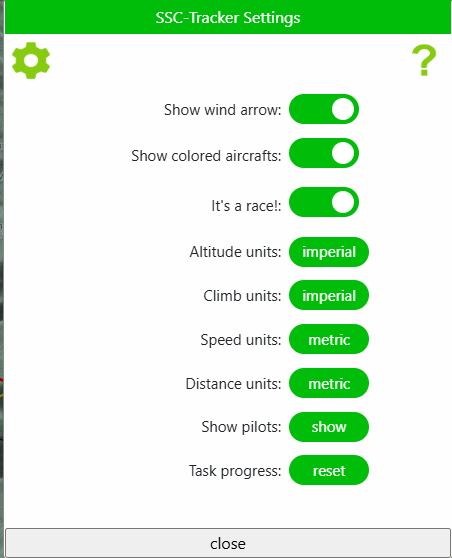
The gear wheel opens the settings. This is where the basics such as units are set.
Preflight map
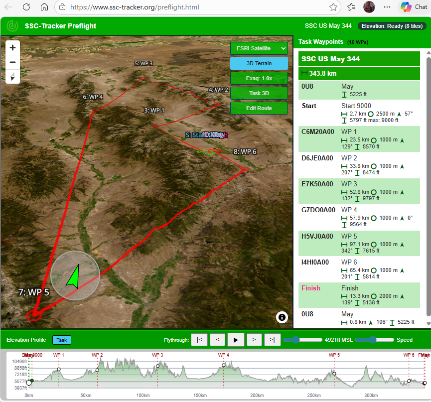
The Preflight map is an extended planning map and can be opened in a browser at http://www.ssc-tracker.org/preflight.html. It uses a 3D-capable map view with a terrain model for flight preparation.
Functions
- Task display: the route with its turnpoints on the map, the waypoint list in the sidebar.
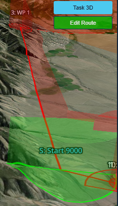
- 3D terrain: optionally with a height texture.
- Terrain profile: shows the terrain along the route (see Elevation).
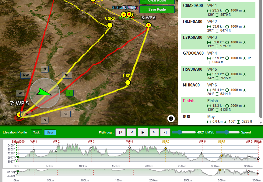
- User route: your own route, freely editable - set points by clicking, move them, delete them. Saved as
userroute.jsonin the task folder. - Map layers: switch between terrain, satellite and other tiles.
Sidebar
The right-hand sidebar shows:
- task name and route
- the waypoint list with name, distance to the next point and sector type
- the waypoint you click is highlighted on the map
A second device on the LAN
Map and Preflight run in any browser - including on a second device on the same network. The addresses for that are collected under ☰ → Connections, each of them twice: once for this PC (localhost) and once for the network (your machine's IP address).
| Entry | Purpose |
|---|---|
| Map | The moving map with the field and the scoreboard |
| Mini FC | The small flight computer |
| Whazzup | Text format for Little Nav Map |
| JSON | The full data set for your own tools |
If the window says "LAN access is off (this PC only)", the web server is listening to this machine only. One click on Enable LAN access sets the necessary URL reservation and the firewall rule in a single admin step; then close the window once and open it again.
www.ssc-tracker.org map
If you open www.ssc-tracker.org on your local PC, it connects to the SSC-Tracker app running on that same PC by itself.
To see the map on a second PC or a tablet, open a browser there and go to http://[IP SIM PC]:55055/map.
(Scale the interface +/−, dock left or top, show/hide the aircraft data)
Click the gear wheel to show and hide the available data fields.
Little Nav Map
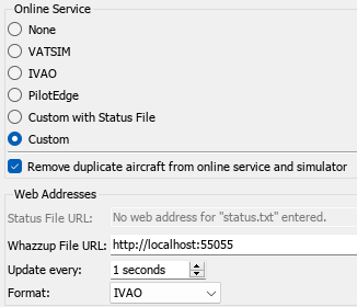
LNM supports the Whazzup v1 format, and SSC-Tracker serves it on localhost:55055, or from the LAN through the IP address of the PC the SSC-Tracker app runs on.
SSC-Tracker also writes a Whazzup file, which LNM supports as well, should the HTTP connection give you trouble. Copy the URL or the path of your choice from ☰ → Connections.
Note: LNM does not support the /json formats.